


ORAIBI Voting District, Maricopa County, Arizona
About
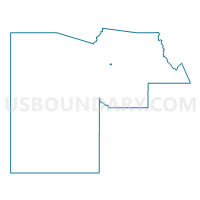
Outline

Summary
| Unique Area Identifier | 524035 |
| Name | ORAIBI Voting District |
| County | Maricopa County |
| State | Arizona |
| Area (square miles) | 0.49 |
| Land Area (square miles) | 0.49 |
| Water Area (square miles) | 0.00 |
| % of Land Area | 100.00 |
| % of Water Area | 0.00 |
| Latitude of the Internal Point | 33.66582710 |
| Longtitude of the Internal Point | -112.05709400 |
Maps


Graphs
Select a template below for downloading or customizing gragh for ORAIBI Voting District, Maricopa County, Arizona


Neighbors
Neighoring Voting District (by Name) Neighboring Voting District on the Map
- BUFFALO RIDGE Voting District, Maricopa County, AZ
- CIELO GRANDE Voting District, Maricopa County, AZ
- DEER VALLEY Voting District, Maricopa County, AZ
- KERRY Voting District, Maricopa County, AZ
- ROCKWOOD Voting District, Maricopa County, AZ
Top 10 Neighboring County Subdivision (by Population) Neighboring County Subdivision on the Map
Top 10 Neighboring Place (by Population) Neighboring Place on the Map
Top 10 Neighboring Unified School District (by Population) Neighboring Unified School District on the Map
Top 10 Neighboring State Legislative District Lower Chamber (by Population) Neighboring State Legislative District Lower Chamber on the Map
Top 10 Neighboring State Legislative District Upper Chamber (by Population) Neighboring State Legislative District Upper Chamber on the Map
Top 10 Neighboring 111th Congressional District (by Population) Neighboring 111th Congressional District on the Map
Top 10 Neighboring Census Tract (by Population) Neighboring Census Tract on the Map
- Census Tract 6168, Maricopa County, AZ (5,595)
- Census Tract 6167, Maricopa County, AZ (4,738)
- Census Tract 6169, Maricopa County, AZ (4,288)
- Census Tract 6149, Maricopa County, AZ (3,495)
- Census Tract 6147, Maricopa County, AZ (2,612)